In our work with Marion Council, Minister David Speirs, and Way2Go (Department of Planning, Transport, and Infrastructure) we have been looking for multiple solutions to improve the situation of safety & traffic around Woodend PS.
One aim is to improve the situation for our pick up/drop off zone – which we have done by extending the Kiss & Go and we will continue to work together with Marion Council to monitor this zone.
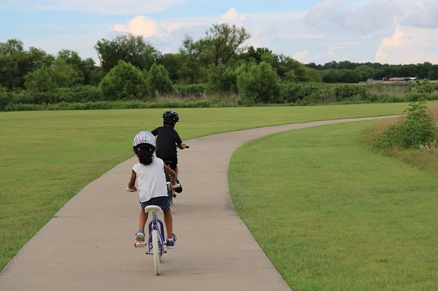
Another aim is to improve the situation for walking/riding to school – more walking/riding means less traffic on the roads nearest the school. We want to create both safer and easier access to the school for pedestrians, bikes, scooters, and prams.
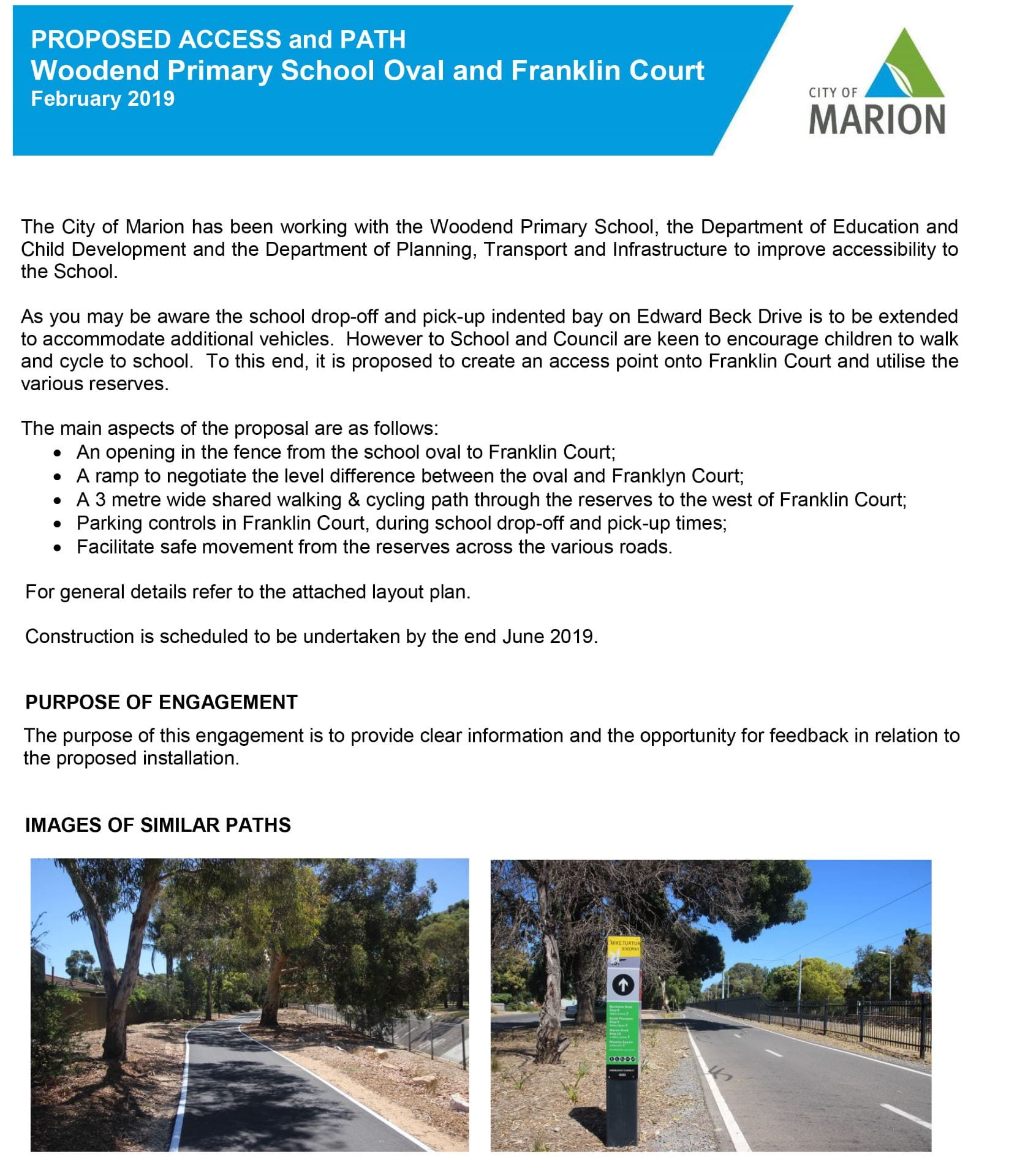
We’ve been looking at how families access the school and one area we feel could make a big difference is to improve both safety and ease of access on the west side of the school – through the end of the oval all the way to Berrima Rd – via the creation of a paved pathway and an access point.
Below you will find an image showing the location of the proposed pathway, through the reserves that run from Franklin Court through to Berrima Road, as well as the proposed access point through the oval fence into Franklin Court.
You will also see the letter which has been sent out to residents living in the vicinity of the reserves… though we believe this pathway will have a far wider impact, particularly for families living to the south and west of this proposed pathway.
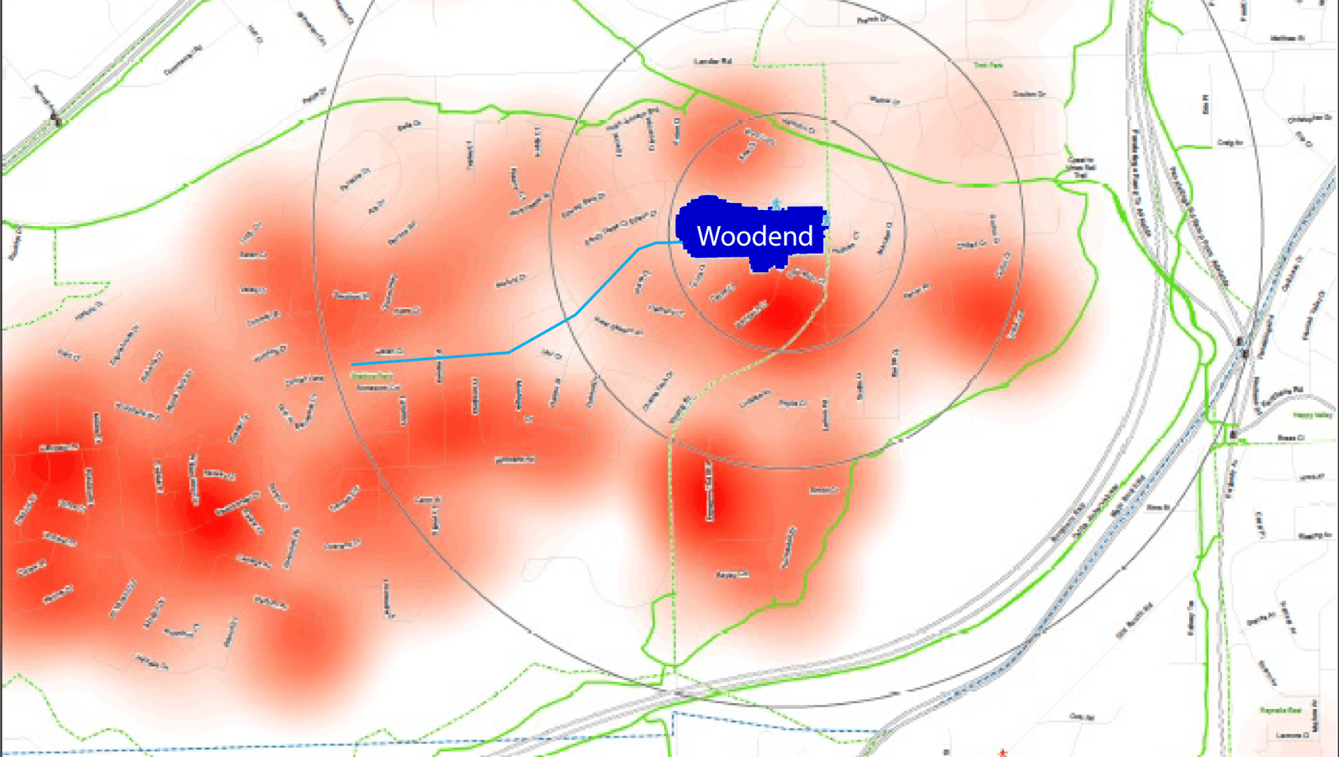
You can see this in the density map image we’ve included below – with red areas showing where Woodend families live and the proposed pathway in blue.
Governing Council and Traffic & Safety committee believe the pathway and the access point – along with safe crossings along that pathway – will make it safer, easier, and faster for families who walk/ride to school.
- Currently there is no path through the reserve making it difficult for bikes, and impossible for scooters and prams, to travel through.
- Both the pathway and the access point allow pedestrians/bikes/scooters/prams to easily travel on the west side of the school and avoid the busiest streets for car traffic.
- The access will reduce the number of pedestrians walking/riding through the kiss & go section of Edward Beck, which gets very crowded and difficult to navigate.
- The pathway is a great opportunity to create safer crossings on some of the busier roads in our neighborhood (such as Berrima Rd and Great Eastern Ave.)
- The pathway and access will make the trip to school easier and quicker for some families.
- The pathway and access point can be used for recreation outside of school time as well – safer places to walk, bike, scoot, skate, and play in our neighborhood.
- The access will allow all residents to the west of the school to easily access the school oval and the new play spaces which will be developed over the next two years.
You may not receive a letter about the proposed access and paths but may still wish to support this proposal. I encourage you to email council@marion.sa.gov.au with your feedback by 8 March 2019.
If you walk/ride to school and notice things along the path that are unsafe (lifted or cracked sidewalks, branches across pathways, etc.) please contact council directly. The Snap Send Solve App is an easy way to do this – and council is responsive.
If you have other ideas for improving routes to school for walking/riding – areas where you believe better crossings, paths, or access is necessary – please email wpsgoverningcouncil@gmail.com as Way2Go is very keen to work with us on this.
Please note that the committee is also exploring ideas for bike safety instruction, road safety information, walking/riding groups, and more. If you are interested in joining the Traffic & Safety committee do send an email – we would love your input and help.
Thanks!
Karen Gunton
Governing Council Chairperson
Image showing proposed Path & Access:

Woodend Density Map: red areas show density of Woodend Families, blue line is proposed path

Leave a Reply